
The network of dismal streets stretching over the surrounding neighbourhood contains a population for the most part of the poorer order. In the thoroughfares where shops abound, the sordid straggle with poverty shows itself unreservedly on the filthy pavement; gathers its forces through the week; and, strengthening to a tumult on Saturday night, sees the Sunday morning dawn in murky gaslight…
Situated in such a neighbourhood as this, Vauxhall Walk gains by comparison, and establishes claims to respectability which no impartial observation can fail to recognize. A large proportion of the Walk is still composed of private houses. In the scattered situations where shops appear, those shops are not besieged by the crowds of more populous thoroughfares. Commerce is not turbulent, nor is the public consumer besieged by loud invitations to ‘buy’. No Name, Wilkie Collins
In his 2025 paper for the Social Science Research Network, researcher Leslie Katz suggests that Vauxhall Walk may have provided the model for the setting scenes in Wilkie Collins’ serialised novel No Name, published in 1862-3. Katz provides evidence that Collins based his descriptions directly on a then existing row of buildings.
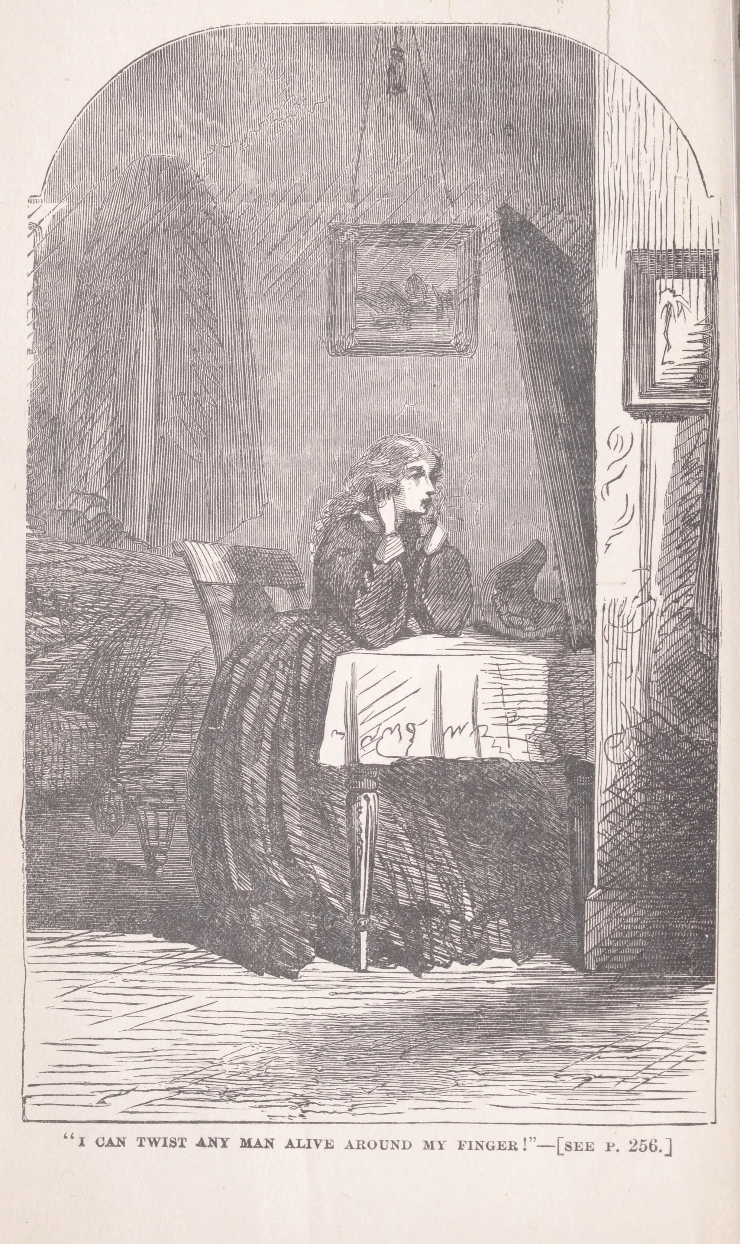
In the novel, the Vauxhall section of which is set in 1847, the heroine Magdalen Vanstone lodges on the first floor of a house in Vauxhall Walk in order to spy on the villain, Noel Vanstone, who lives in one of a row of houses opposite. These were, according to Wilkie’s description, ‘of superior pretensions in size and appearance to the other houses in the Walk: the date at which they had been erected was inscribed on one of them, and was stated to be the year 1759. They stood back from the pavement, separated from it by little strips of garden-ground. This peculiarity of position, added to the breadth of the roadway interposing between them and the smaller houses opposite, made it impossible for Magdalen to see [from her room overlooking Vauxhall Walk] the numbers on the [front] doors [of the houses on the other side of the Walk.]’
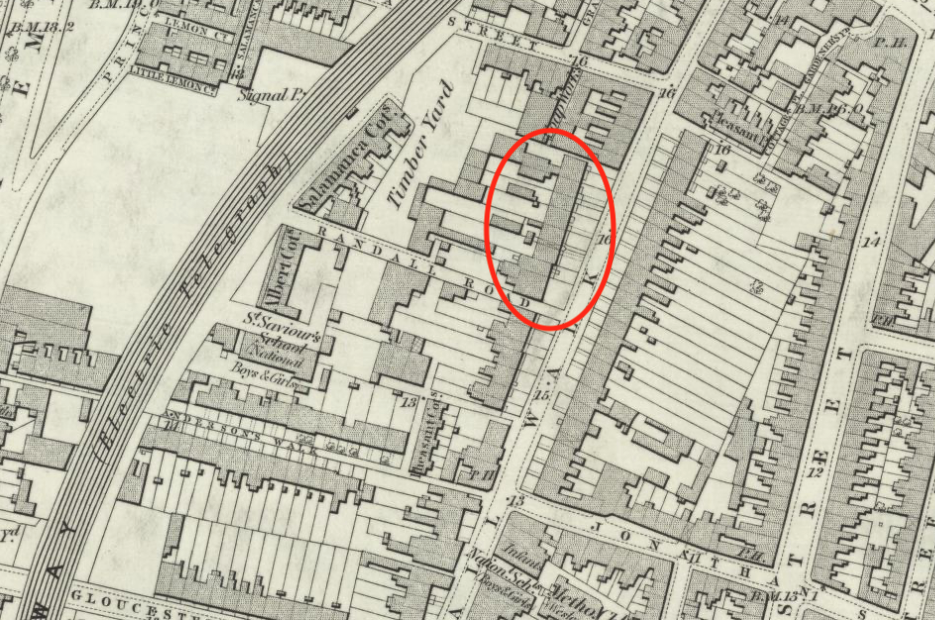
Katz has identified Noel Vanstone’s abode as one of eight houses in a terrace, numbers 28 to 42, on the western side of the street between Randall Road (or Row) and Salamanca Street. The buildings were substantial residences with three storeys plus a basement and front gardens. In Charles Booth’s Poverty Map (1886-1903) this section of Vauxhall Walk is marked as ‘Some comfortable, others poor’.
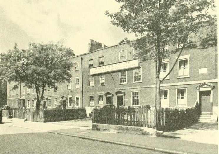
The Second World War Bomb Damage survey shows that apart from, notably, the mineral water factory opposite the terrace, Vauxhall Walk escaped mostly unscathed. Ordnance Survey maps show that the terrace was standing in the early 1950s but was demolished at an unknown date. The site is now Pedlar’s Park.
Reference
Katz, Leslie, Did Wilkie Collins Use in No Name a Group of Eight Terrace Houses that he’d Seen in Vauxhall Walk, Lambeth? (September 17, 2025). Available at SSRN: https://ssrn.com/abstract=5499379 or http://dx.doi.org/10.2139/ssrn.5499379